
Orangetown Previous Residents by Era
Previous residents are best traced with a sequence of dated sources. Begin with the newest dependable parcel and deed information, then work backward through the people-and-address material held by libraries and archives. The sources overlap, but none supplies a complete chain by itself. A title document can identify transfer parties, while a directory or census can attach a household to a place at a particular time. Record the address as printed, the legal description or parcel, and the person or entity in separate notes.
| Source | Years It Covers | Where Held | What It Shows |
|---|---|---|---|
| Cott land-record snapshot | 1/2/1930–8/14/2026 checked snapshot | Rockland County Clerk portal | Recorded title instruments, parties, dates, and image/index access |
| Cross Reference Directories | 1978-1999 | New City Library Rockland Room | Address-to-subscriber and name/business cross-reference |
| Telephone-book runs | Nyack 1883-1890; Rockland County 1910-1998 | Rockland Room microfilm | Dated subscriber, name, business, or address context |
| Federal census material | 1790-1930 locally listed | Rockland Room, NARA, and FamilySearch routes | Enumeration-time household and locality details |
| New York State census and enumerations | State census 1860-1925; enumerations 1830-1920 | Rockland Room, FamilySearch, and State Archives paths | Household and locality snapshots |
| Nyack Sanborn map | 1896, 12 verified sheets | Library of Congress online | Building footprint, use, and street context, not a person list |
Building-permit start years were not located in official sources. For a defined address and period, ask the Town Building office or use the local FOIL route for existing files rather than assuming an online permit index covers the past.
Cott Snapshot for Orangetown Previous Residents
The Rockland County Cott land-record portal is the online starting point for a newer deed chain. The checked Certified Dates screen showed land records from 1/2/1930–8/14/2026 and miscellaneous filings from 10/5/2004–8/14/2026. Treat both ranges as a portal snapshot observed during research, not a promise that each document or image is online. Guest viewing is available, while printing requires an account under the portal's stated terms.
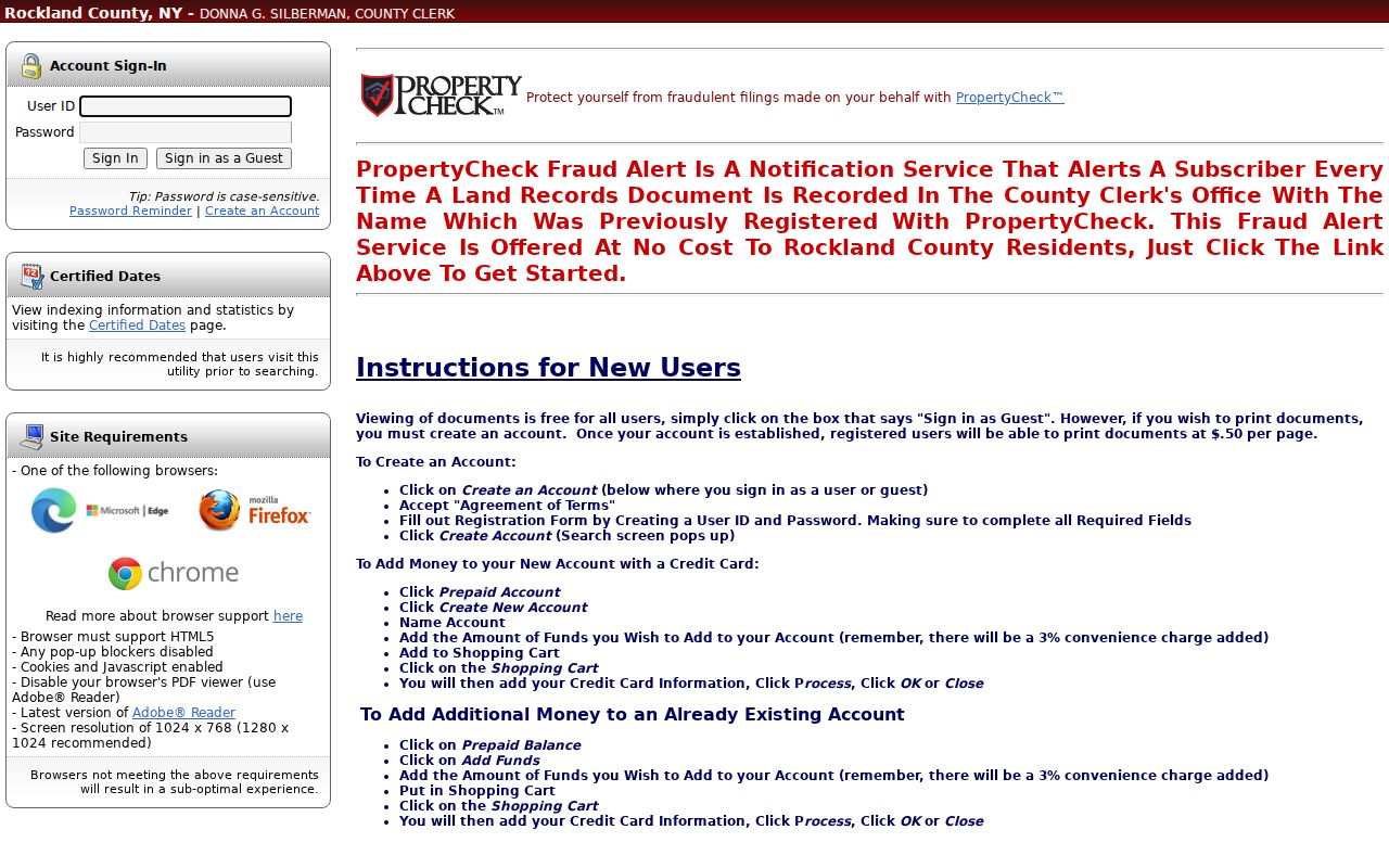
The gateway view confirms the correct record system, but the inspected search screen did not expose the complete guest deed-index fields. Use the visible date coverage as a boundary, then read the actual deed, not just a name in an index.
When an older record falls outside the online trail, use the County Clerk's land-record instructions, the public search room, mail request route, or Archives Records Management. The Clerk's Office and Archives are the fallback for deed books, film, older indexes, and series that are not searchable through the portal.
Tracing Orangetown Previous Residents Through Deeds
A backward title chain begins with the present parcel information, not with a surname guess. BAS can locate a tax-map number, property address, or owner name, and RocklandGIS can help match the parcel to the street and map context. The next task is to locate the most recent deed and use its own legal description, instrument number, transfer parties, and prior-reference language. A deed proves a land transfer. It does not, by itself, prove that a party lived at the property.
- Search the Town BAS route by property address, tax map number, or owner name and preserve the result date, parcel label, and collection year.
- Open or order the latest recorded deed and copy the grantor, grantee, recording date, instrument number, and legal description.
- Search the latest seller, the grantor, as an earlier grantee. This often finds that seller's own purchase.
- Repeat the grantor-to-grantee reversal, checking spouse names, estates, trusts, entities, and old parcel wording against the legal description.
- When the online snapshot stops, request the earlier deed book, page, film, or index from the Clerk or Archives.
- Grantor
- The party transferring an interest in recorded land.
- Grantee
- The party receiving that interest. Searching a seller as a grantee is the usual backward-chain move.
- Chain of title
- The dated sequence of recorded transfers used to follow one parcel through successive parties.
- Legal description
- The lot, block, map, metes-and-bounds, or other title description that can bridge an old street label to the same land.
Orangetown Previous Residents and Old Labels
Old local labels often interrupt a previous-residents search. A source can say Nyack, South Nyack, Grand View, Piermont, Tappan, Pearl River, Sparkill, Palisades, Orangeburg, or Blauvelt when the modern research notes use Orangetown. Save both forms. An address near the river can also carry ferry, landing, or village language that no longer appears in the same way on a newer map.
South Nyack is a particularly useful before-and-after switch. Its village government dissolved in 2022, and Justice Court matters transferred to Orangetown on April 1, 2022. Search the former village wording alongside Orangetown when the date is near that change. There is no verified official master street-renumbering list, so do not invent a renumbering explanation when the address trail breaks.
Note: a situs address, postal label, tax mailing address, and legal description can refer to different geographic or record functions.
Orangetown Past Residents in Directories and Census
After the deed chain names a former party, switch to the household layer. The Rockland Room's 1978-1999 Cross Reference Directories can start with an address and lead to a subscriber name. Nyack telephone books cover 1883-1890, and Rockland County telephone books cover 1910-1998. These records can help locate past residents, but they may omit unlisted people and do not establish title.
The companion collections are summarized on the Orangetown city directory page. Pair an address directory year with the closest available census and then test the result against newspapers, deed records, or probate. The listed local federal census material runs from 1790 to 1930; New York enumerations run from 1830 to 1920 and State census material from 1860 to 1925. The 1892 Rockland County Census is a useful aid, but the original image and spelling still need checking.
- Start at the known address in a cross-reference or telephone directory and save the source year.
- Search the related name in the matching or nearest census schedule, using the hamlet label from that period.
- Compare ages, relatives, business references, and street details before treating two entries as one household.
- Search newspapers for a move, death notice, legal notice, marriage, or local event that helps bracket the date.
- Use probate, cemetery, church, or obituary material as an endpoint for a deceased former resident.
1896 Nyack Map for an Orangetown Address
The Library of Congress offers the 1896 Nyack Sanborn map set, a verified group of 12 sheets. It can answer a narrow property question: whether a building footprint, use, street intersection, or fire-protection feature appears in that edition. Compare it with the deed's legal description, a later tax map, and the current GIS parcel.
The map does not name every person at an address. Use it as a building-era test, especially where a directory scan is missing or a riverfront street label changed. A footprint match can strengthen a parcel history, while a mismatch signals that the address, street layout, or building changed and needs more checking.
Orangetown Past Residents Beyond Online Indexes
Several local institutions can fill gaps in an address timeline. The Rockland Room holds newspapers, directories, census materials, maps, photographs, church and cemetery resources, and limited court material. Orangetown Museum accepts genealogical inquiries and appointment research; its PastPerfect catalogue is a finding aid, not a person search. The Historical Society of Rockland preserves county manuscripts and local publications, while Nyack Library maintains local-history images and oral histories.
Ask a repository for a precise record family: a surname and date window, former street label, deed reference, Sanborn sheet, tax-map history, newspaper title, or vertical file. There is no official Orangetown-specific house-history guide in the reviewed sources. A focused question gives staff a realistic way to identify an available box, volume, or image without implying that every historical record is online.
Orangetown Previous Residents in Local Memory
Previous residents become more than names and dates when a local source supplies the community setting. Nyack Library's local-history resources include images, oral histories, postcards, newspapers, and the Nyack Record Shop oral-history project for Nyack, Upper Nyack, South Nyack, Grand View, and nearby communities. An oral-history account can point to a school, storefront, church, rail stop, or riverfront feature that explains why an address is described differently in a deed or directory.
Use that material as context, not as independent proof of a person's address. A sound record trail pairs a remembered name or photograph with a dated telephone entry, census, newspaper notice, tax record, or deed. The Orangetown Museum can help with provenance and family or institution material through an appointment, while the Historical Society's collections can help test a local event or spelling. These sources are especially useful when previous residents are indexed under an old hamlet name rather than the current Town label.
Note: archive staff can identify a collection without disclosing private details about living people.
Lawful Orangetown House-History Research
Past-resident research is most useful for family history, estate questions, property history, and local curiosity. Preserve source dates and distinguish a deed party from a directory subscriber, a census household, or a court name. Do not use a historical record to track, contact, or expose a living person.
Lawful use. Use Orangetown previous-resident records for legitimate historical research, and stop before turning public fragments into a profile of any living person.
For the current address-keyed chain, use the Orangetown street directory workflow to verify the parcel and official map context one record at a time. Note: a good historical trail states what each record proves and leaves uncertain links clearly marked.